Yukon Delta, satellite image. The Yukon River rises in Canada and crosses the US state of Alaska before emptying into the Bering Sea at this delta, along with the Kuskokwim River. There are countless lakes, sloughs, and ponds formed and surrounded by the river's branching waterways. This is one of the largest river deltas in the world, protected as part of the Yukon Delta National Wildlife Refuge.
US Geological Survey / SPL / mediadrumworld.com
Sensational Satellites
By Zoe Cassell
PSYCHEDELIC satellite images of our planet will leave you wondering whether they are in fact abstract pieces of art.
Agricultural landscape in Kazakhstan, satellite image. The fields in this area of eastern Kazakhstan follow the contours of the land. This results in long and narrow fields in mountain valleys, and large and rectangular fields on the plains. The differing crops and soils form a patchwork of colours. US Geological Survey / SPL / mediadrumworld.com
In one picture graphic turquoise and yellow shapes make up the agricultural landscape of Kazakhstan in the Far East, while another photo of the Sahara Desert in Algeria is displayed in a shocking tie-dye effect of reds and fluorescent yellows.
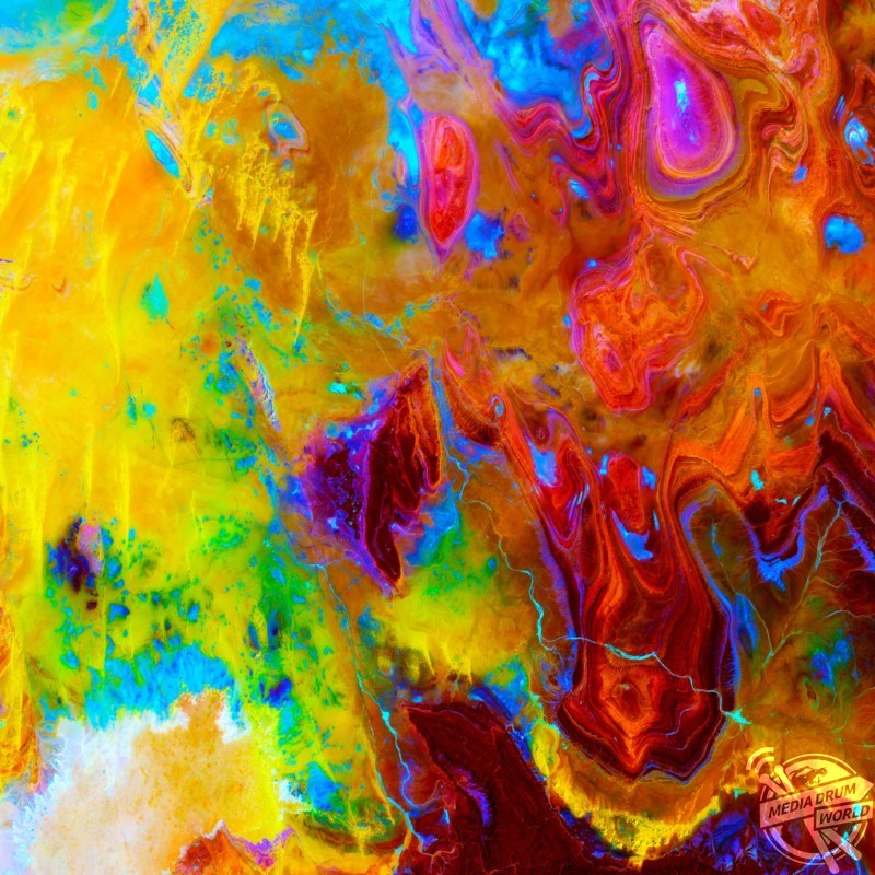
Algerian Saharan landscape, satellite image. Known as the ‘Land of Terror’, the Tanezrouft Basin in Algeria is one of the most desolate parts of the Sahara Desert. It has no water, no vegetation, and no oases. The harsh landscape includes sand dunes and sandstone formations, carved by relentless wind erosion into the patterns seen here. US Geological Survey / SPL / mediadrumworld.com
These arty displays of our natural world were captured by the Landsat 5, 7 and 8 satellites and were published in the US Geological Survey.
Belcher Islands, satellite image. The Belcher Islands, which were named after the British Admiral Sir Edward Belcher (1799-1877), are located in Hudson Bay, Canada. The islands’ only inhabitants live in the small town of Sanikiluaq, near the upper end of the middle island. These rocky islands are too cold to sustain more than low-growing vegetation. US Geological Survey / SPL / mediadrumworld.com
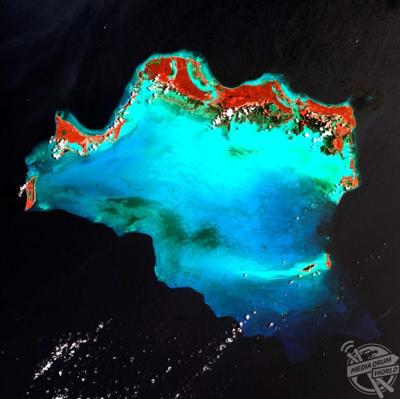
The popular tourist spot of the Caicos Islands in the Caribbean are displayed as a splash of dazzling blue surrounded by a burnt orange mass of sand, algae and coral.
Caicos Islands, satellite image. The Caicos Islands in the northern Caribbean are a popular tourist attraction, with beaches, luxury resorts and and clear waters for scuba diving. The islands lie along the northern perimeter of the submerged Caicos Bank (turquoise, centre), a shallow limestone platform formed of sand, algae, and coral reefs. US Geological Survey / SPL / mediadrumworld.com
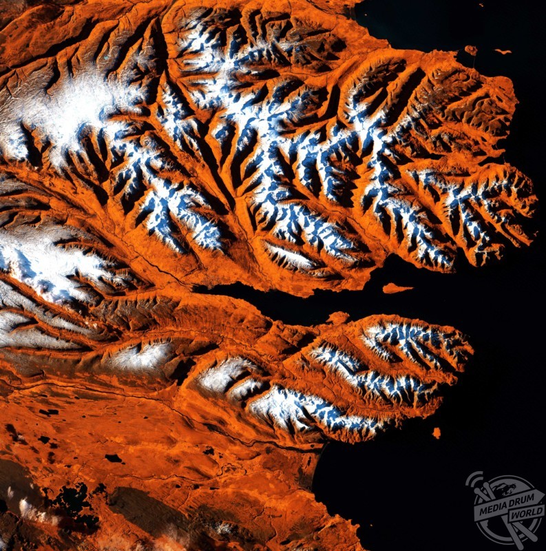
In another image, the infamous Icelandic fjords have become a deep orange colour, dusted with a sprinkling of white snow and mountains carved like tree branches.
Icelandic fjords, satellite image. This area of Iceland’s northern coast is centred on the Eyjafjordur, a deep fjord that juts into the mainland between steep mountains. At its mouth is the small Hrisey Island. The ice-free port city of Akureyri lies near the fjord’s narrow tip, and is Iceland’s second largest city after the capital Reykjavik. US Geological Survey / SPL / mediadrumworld.com
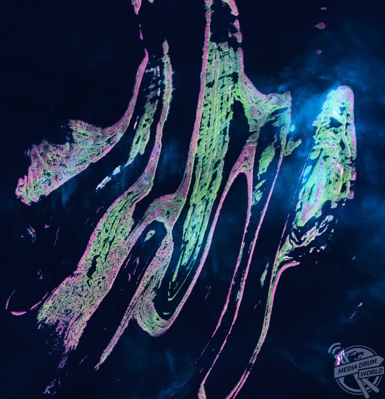
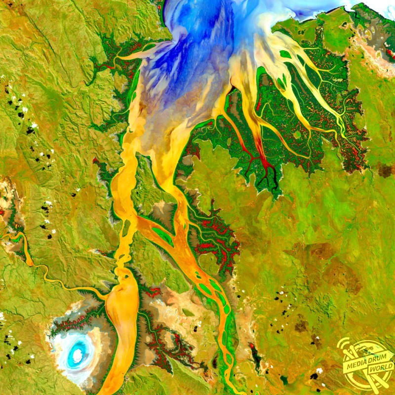
The Ord River estuary in Western Australia can be identified by its yellow veins of water coming from a brilliant indigo patch at the top. The dark green surrounding the yellow veins are the mangroves and the bright white and blue eye in the bottom left is an area of mudflats home to saltwater crocodiles.
Ord River estuary, satellite image. Mangroves (dark green) grow along the banks of the Ord River in the Kimberley region of Western Australia. Yellow, orange, and blue colours indicate the flow patterns of sediment and nutrients in this tropical estuary. The bright spot at lower left is an area of mudflats, home to saltwater crocodiles. US Geological Survey / SPL / mediadrumworld.com
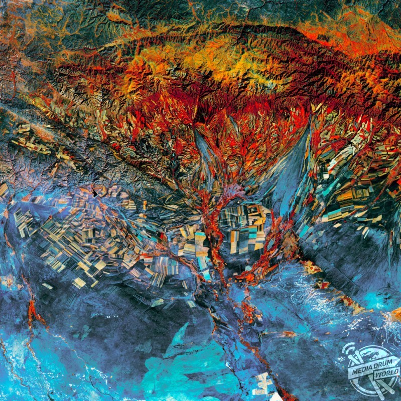
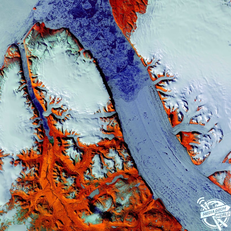
Another satellite shot shows the Petermann Glacier in Greenland with its orange branch-like shapes moving away from a diagonal curved line of pale blue. In this infrared image the warm colours represent areas which in the summer are cleared of snow
Petermann Glacier, satellite image. This tidewater glacier, located on the north-western coast of Greenland, terminates in a giant floating ice tongue. This extends from bottom right towards upper left. At 15-20 kilometres wide and 70 kilometres long, it is the longest floating glacier in the Northern Hemisphere. The infrared imaging used here shows bare ground (red) that is ice-free in the summer. US Geological Survey / SPL / mediadrumworld.com
This fantastic collection of photographs demonstrates just how beautiful our planet is.